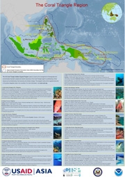
Map: US CTI Support Program Integration Sites, November 2011
Document Date:
01 November 2011
Author:
US CTI Support Program
Download/preview files:
| # | Documents | Filesize |
|---|

Map of 13 US CTI Support Program-supported sites including fast facts such as total area, population, biodiversity features of each site. Base map created through the Coral Triangle Atlas.


